


Tuesday 5/19: Feast or Famine
- silsmichael
- May 19
- 1 min read
Good Tuesday Evening, Chief Meteorologist Mike Sils here.
We saw some decent rainfall in Isolated spots today across South-Central IN, Paducah and Louisville area.

OTHERWISE, it was another HOT & Dry Afternoon with many near 90° as the urban areas exceeded them. This was Bowling Greens warmest day of the Year so far.

Luckily, we will Not be that Hot on WEDNESDAY. If we keep the clouds around and morning showers, Temperatures will hold steady but the humidity will stick around keeping us humid due to that stalled front I mentioned in last nights post.
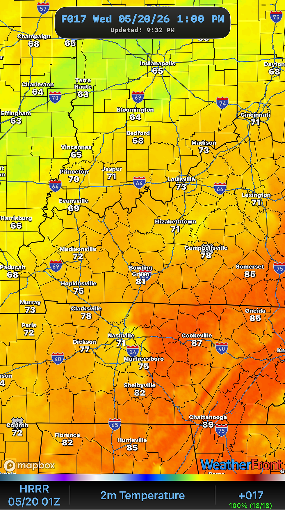
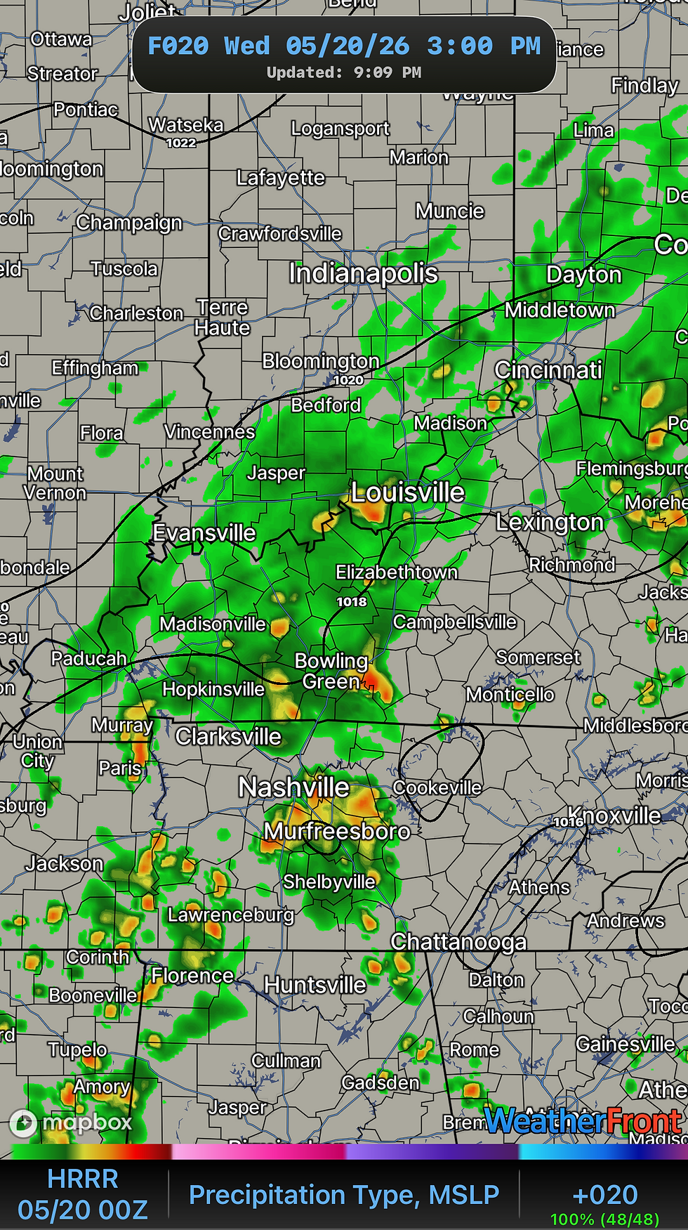
WEDNESDAY will continue keep the shower chances across the Region as they’ll be a garden variety. I do think the Boundary will transition a little more East than Tuesday as shower chances are more possible along I-65 Corridor from Louisville to Nashville.

Reason I think we can see the Storm chances along the I-65 Corridor is some weak Low level energy out of MiddleTN that can enhance a little “lift” for higher storm chance. Rain will be scattered in Nature but Amounts could be impressive if these are slow moving since wind energy is very weak. This is the forecasted Rainfall Amounts through Thursday Evening.

That’s all I have tonight! Tomorrow we can start looking ahead for the Memorial Day weekend forecast.
-Mike


Comments