


5/31 Sunday PM: An MCS Monday Mischief
- silsmichael
- 2 days ago
- 2 min read
As we start off Meteorological Summer for Monday, an overnight organized cluster of storms (Mesoscale Convective System) is forecasted to form out of the Midwest and drop Southeast by mid-morning Monday into the Lower OH Valley and MidSouth.


RIGHT NOW, the Best placement of Storms will be along & West of I-165 & points WEST into Western KY/TN. Since Friday, the placement has been consistent with trends for where I just mentioned. I think anywhere East of I-165 can still see showers and maybe a few storms embedded but the best convective and severity will be West. The track of the Mid Level Flow of this Shortwave Trof favors how the current Surface Map currently looks. Wind energy will keep these storms to be strong to severe with mainly a Damaging Wind hazard. At this time, tornado threat looks very low.


The Surface Map shows a good illustration where the linenfo storms likely will “funnel through” as both weak frontal boundaries I outlined in YELLOW will drape where the cluster likely wide. This is why I think Western KY/TN will have the best storm shot.
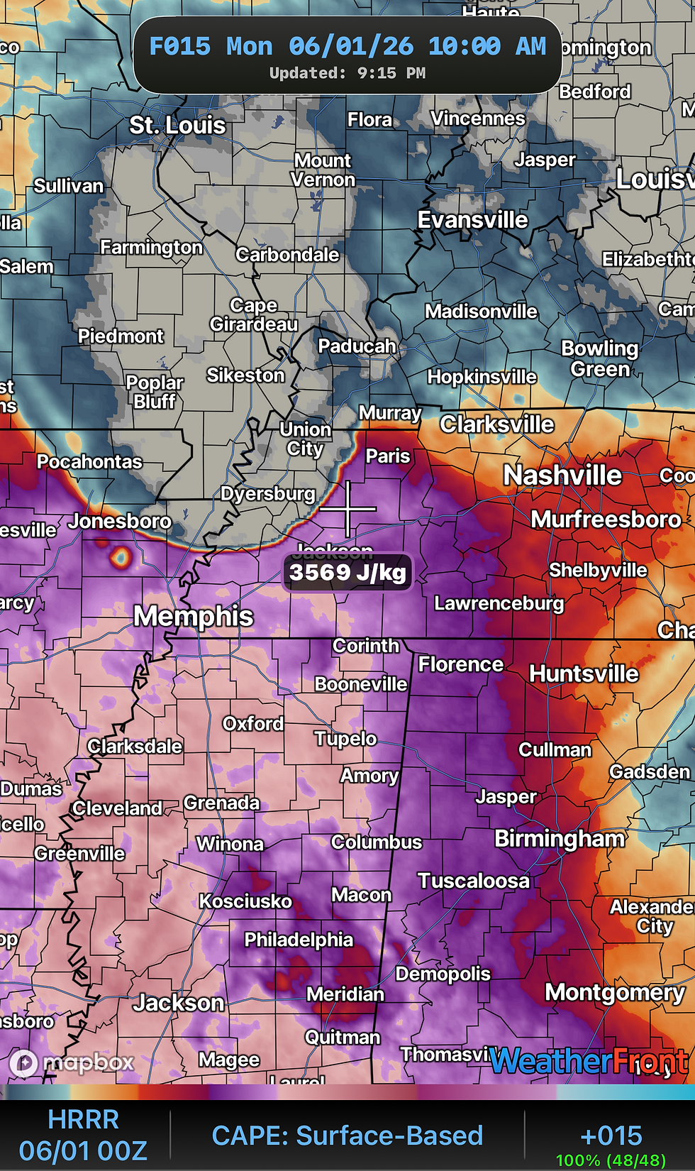
STORM SEVERITY looks Low for now as SPC has placed a Level 1/5 (Marginal Risk) for much of Middle/West TN and KY for damaging winds. It will be Humid! The Storm juice we call it or CAPE (Convective Availability Potential Energy) will be high for lots of Updrafts and Energy to create loud storms when you head into work.

Now, once the airmass recovers into the Afternoon after clouds and storms, there will be a window as another Shortwave could be impacted for another round of Showers into Monday Evening. Just throwing it out there.
Have a good Late Sunday Evening and a Monday! Helllooooo June!


Comments