


OTD 5/30/2004: Memorial Day High Risk
- silsmichael
- 3 days ago
- 2 min read
On Indy 500 Sunday, if your a racing fan, it was a wet and dreary start across Southern IN and all of KY. A warm front to the Southwest was lifting Northeast across the Region. Moisture began to increase with dewpoints surging well into the Low-70°s from the Southwest. This region was now in the Open Warm Sector ahead of a deepening area of Low Pressure with a Cold Front West of the Mississippi River.

The SPC had one of the largest High Risk placements I have ever seen, but the Open Warm Sector was so large. Another trigger was a stalled Warm Front draped over I-64 Corridor that provided lift with East to West Surface winds with strong SW midlevel winds.
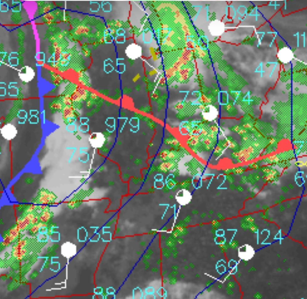
Once the airmass recovered by MidDay, Sunshine was prevalent and Cumulus clouds were making showing up on Satellite as the airmass started to destabilize.

By Midday, Several Supercells started popping up like wildfire along & South of I-64 and West of I-65 across Southern IN and KY. Some were low top Supercells near the Warm Front in Louisville area but some in Western KY were full blown Supercells. A F3 Tornado occurred in Crawford Co (Marengo,IN) and one smaller Tornado across the River in Jeffersonville, IN. One smaller Tornado also occurred in Southern Jefferson Co in Glenmary Subdivision of Fern Creek.


After the low top Supercells passed farther North & East in KY/IN, the storms moved toward Cincinnati area and toward I-75 Corridor. Another Tornado was near Speedway, IN on W side of Indy right after the Race where a F2 Tornado, produced.

Once the storms left, the atmosphere once again, RECHARGED. It seemed like the Airmass never was done and it wasn’t. The Mid Level Vort Maxima was gaining steam East as it became Negatively Tilted; lots of energy with winds spreading apart in different directions as you went up in Air. ALSO, as the night wore on, the Low Level Jet Stream increased by Sunset. Winds at 5000’ were over 40kts helping Storms grow upscale into a Line with Embedded weaker Tornadoes but Wind Damage would be main concern.


IN ALL, almost 900 Severe Weather Reports on that Day as we had over 500 wind and 100 Tornado reports.
This was a benchmark event as Tornado reports were from Minnesota to Alabama!
Hope you enjoy a trip down Memory Lane, this was an active stretch of Weather as well; since days prior a F2 Supercell tracked from Southern IN into Henry Co KY where Eminence was impacted.


Comments