


The Eddyville Tornado Event: A Storm Chasing Analysis Of The EF-3 Tornado In Western Kentucky.
- christopherevans38
- 6 days ago
- 4 min read

Good evening everyone, Chris Evans here. As we have finally gotten through some local days of severe weather I thought it was a good night to fire up a special blog post over a review of the 2024 western Kentucky severe weather outbreak on May 26th in 2024. This tornado caused 1 death and 21 injuries. We will talk about the setup, look at radar and the evolution of this day and how conditions became so favorable for a strong tornado in western Kentucky.

This day began with a morning MCS or (mesoscale convection system). Basically, a line of strong storms with a wind and quick spin-up tornado threat. This did produce a brief tornado warning near Paduch at 9:06 AM on the morning of May 26th.
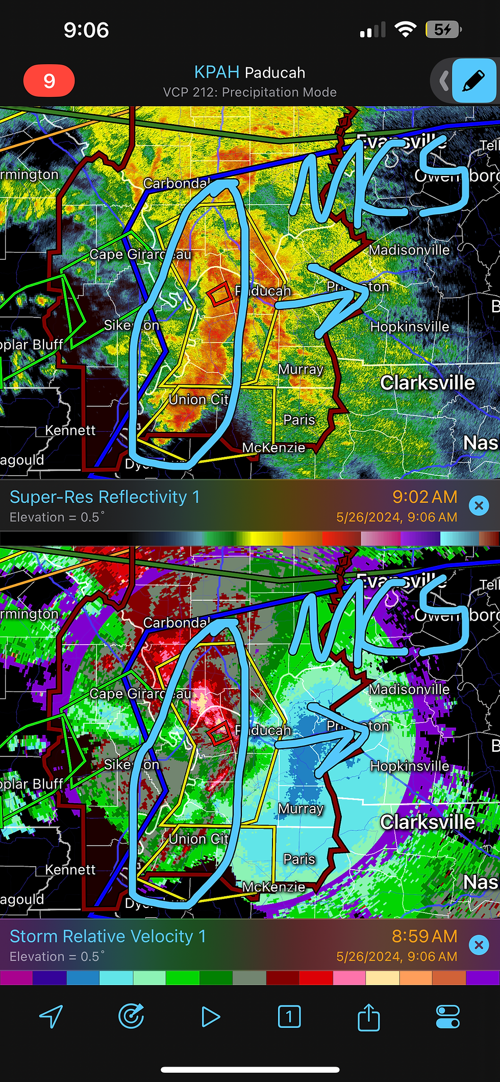
Models struggled with the timing of this MCS, as many models had it moving in much later and leaving this area in cloud cover. Ultimately, the MCS moved in much quicker in the morning leading to conditions becoming more favorable for tornadoes in the afternoon.

By 3:00 PM CST the morning complex of storms was along and east of the I-65 corridor and sun was starting to destabilize the atmosphere in western Kentucky. This led to the Storm Prediction Center issuing a moderate risk in portions of Western Kentucky by the late afternoon. It was becoming clear this day would be a major problem.

This is when the Storm Prediction Center issued a Mesoscale Discussion highlighting areas of Western Kentucky, southern Illinois and southeast Missouri. The environment was ready to produce tornadoes.

At this moment I met with fellow storm chaser Heather Carter west of Eddyville and watched a little tiny cell fire on radar. Heather and I chase events frequently now and really navigated well this entire day! This was my first time meeting Heather and as we watched the towering cumulonimbus clouds, we both IMMEDIATELY knew this cell was going to go big!

By 7:49 this cell was already showcasing supercell characteristics and I began live streaming my chase on Twitter. From my experience in storm chasing in Kentucky it is far more important to watch storm characteristics in person than staring at radar. It is tricky to find visibility in Kentucky, so I knew getting finding the right positioning on this storm was key.

By 8:17 PM this was a full-blown supercell with some hail occurring just north of Western Kentucky Parkway. We stayed south of this hail core and started to watch this large rotating base come closer to us. This thing had a HUGE meso! We were waiting for the right opportunity to get visual on this thing.


As we get close to the rotation, a massive tornado appeared over the trees directly in our sight near Eddyville, Kentucky. We reported this to the National Weather Service and I was live on Twitter reporting this to over 2,000 viewers. We were some of the only chasers to see this tornado at initiation and I was very proud and impressed with Heather's driving skills during this event. Chasing in Kentucky is not easy!

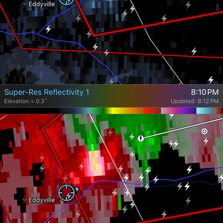


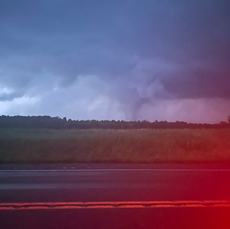
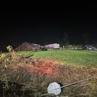
We continued to track this tornado just north of I-69 near Eddyville. It was on the ground for over an hour and tracked over 31 miles while producing a damaging tornado! This is very rare in our neck of the woods! The tornado had multi-vortexes but was mostly a cone tornado during its life-span. This picture was taken by Heather and I along the Bluegrass Parkways as the we traveled parallel with the tornado.


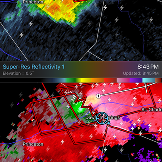
The tornado finally began to rope out near Dawson Springs around 9:15 PM and we watched this happen in our Jeep as we were looking over the tree line. The supercell then became wrapped in rain and the tornado became hard to see at times a the end of its life cycle. There was strong RFD winds rocking the jeep and we couldn't see anything at the end of its life cycle. For the most part, however, this was a very photogenic tornado.


Once we saw this tornado went through a populated area, we immediately went into search and rescue mode. Heather is a member of Search and Rescue for Team Dominator and I have had experience with search and rescue during previous chases. We did not hear much on police scanner but that is common with stronger tornadoes. Heather had a spotlight on her jeep and was able to spotlight any areas affected by damage. We saw extensive Damage near Mortons Gap, Kentucky.


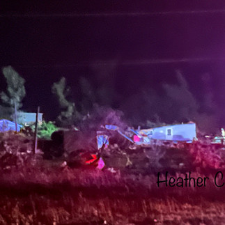
We saw multiple areas of damage and rolled into a mobile home neighborhood that was absolutely devastated by the tornado. After checking with those impacted, they informed me this exact neighborhood was impacted by the 2021 Mayfield tornado. As a result of that tornado, an underground community storm shelter was built and ZERO casualties were reported. An amazing feat in light of devastating tragedy.
This day was a classic Ohio Valley setup where early morning convection moved out quicker than models indicated and left extra spin for supercells in the afternoon. I am extremely grateful that individuals in Morton's Gap took warning and took shelter together, AS A COMMUNITY. Always remember to take care of your neighbor when severe weather hits. Take care and always stay weather aware!


Comments