


Severe Storms To Return Next Tuesday
- christopherevans38
- May 17
- 2 min read

Good evening everyone, Chris Evans here with Zero Meter Chasers. I hope everyone is enjoying this HOT Sunday across the Commonwealth where there were many locations with temperatures in the upper 80s.

Looking at satellite, we have a strong area of high pressure in the OH Valley which is keeping us sunny and dry today.

Any storm threat is localized in the central US where we currently are watching a severe weather outbreak unfold in multiple states in the central US. Looking at satellite, you can see where some explosive thunderstorms are taking place this evening. These storms will form into a QLCS and have a NASTY damaging wind threat throughout the night.

This looks to be just the beginning of a multi-day severe weather outbreak in the United States. Tomorrow's threat looks to be the highest threat we have had yet. The Storm Prediction Center has issued a moderate risk for severe weather in the Kansas and far southeastern Nebraska tomorrow. SPC also has a VERY large slight risk for tomorrow.
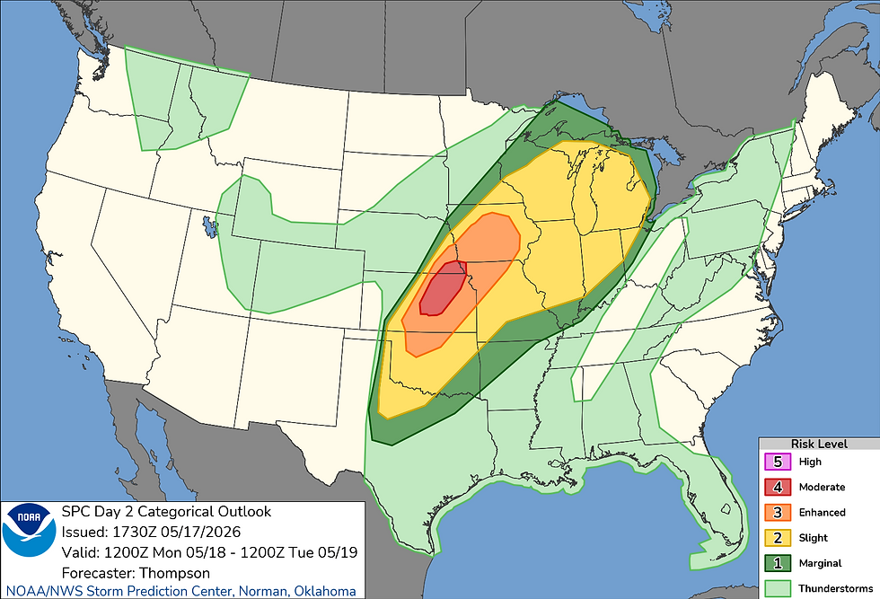
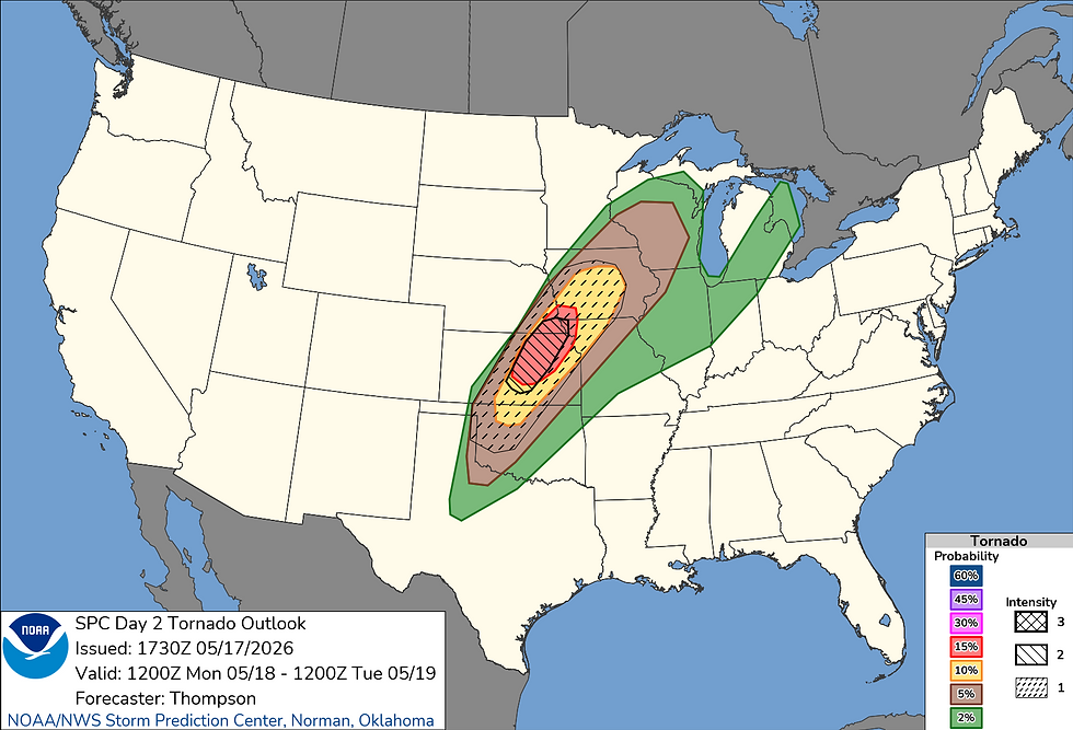
In addition to this moderate risk, the SPC has a 15% hatched tornado risk which is hinting at the possibility for strong to violent tornadoes.
Luckily, we will not have to worry about any severe storms tomorrow here in Kentucky. However, our high pressure is moving away from us allowing for this storm system to start moving east as we get into our Tuesday. The SPC is showing this with a LARGE slight risk of severe weather in the OH Valley on Tuesday!

This is a very large slight risk HOWEVER the SPC only has a 15% risk risk and NO hatching (significant severe weather is not expected as of now). I did want to dive into some model data real quick to cover Tuesday's threat.
Looking at the European model for Tuesday afternoon you can see the EURO is firing storms in the OH Valley along a weak front with our low pressure all the way into Michigan. That low pressure placement really limits available wind shear in the lower OH Valley.


Now despite us having pretty weak wind shear, we will have an extremely moist air mass which will feed thunderstorm complexes in the afternoon on Thursday. The EURO is showing high 60 to low 70 degree dew points in our area Tuesday afternoon.

We dont have much hi-res data on this yet (we will have more tomorrow) but it looks like a line of thunderstorms is going to be approaching from Illinois and Missouri late Tuesday evening. Again, our weaker wind shear is really a limiting factor with this setup so while some severe looks likely it will not be anything compared to what the Central US is facing the next 2 days. Damaging winds and hail will be our main risks.

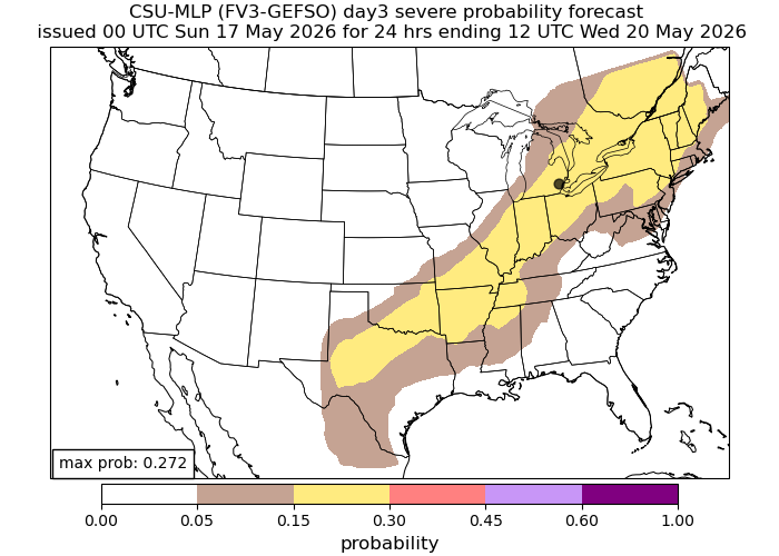
Our AI computer models are picking up on this threat as well. CSU learning model has a board 15% risk for the upper OH Valley.
Monday's evolution is key on how Tuesday's evolves so as always we need to take this one storm at a time! Overall, storms return on Tuesday and we will have a lower-end severe risk. I will have another update early next week. Take care!


Comments