


May 28, 1996: 30 Years Later “Bullitt Co F4”
- silsmichael
- 5 days ago
- 3 min read
This was a very memorable Tornado in the Louisville area if anyone remembered it 30 years ago today.
In fact, This was the FIRST F4 or higher Tornado to impact the state of KY after April 1974 Outbreak, and the last one before the deadly Western KY EF-4 Tonado in December 2021.

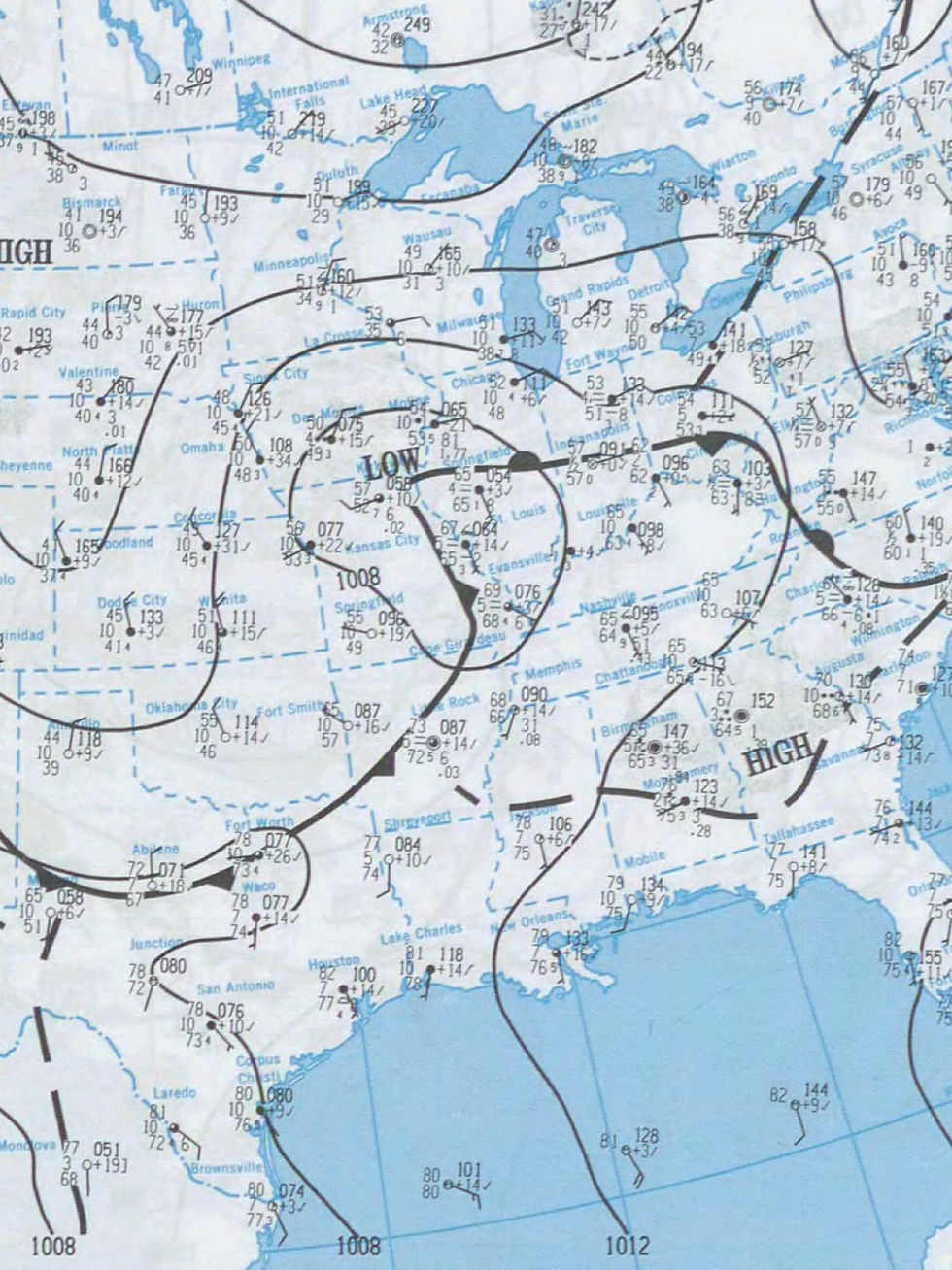
That Tuesday began warm and muggy as a frontal boundary was draped along the I-64 Corridor and just North ahead of an approaching Cold Front to the West. An area of Low Pressure was attached with it. Moisture was in placed and dewpoints well into Upper 60s/Lower 70s kept us sticky and muggy through the day and early evening. The 4 ingredients were at play as the stage was set.
The SPC had a Slight Risk in placed for severe storms. As you see, the Lower OH Valley was socked right into the Open Warm Sector as the Low paralleled along the I-70 Corridor.
Storms began to pop up ahead of the Cold Front as a lone Supercell spruced up in Southern IN as it produced an EF-2 in Crawford and Harrison Co. A unique “split cell” effect took place and the Southern cell choked off the northern cell and hugged the boundary and interacted with the jet stream; bee-lining it toward Louisville Metro area.

The storm was now in a “steady state environment” where nothing around it could interfere the maturity of the storm. As it crossed the River into Southern Jefferson Co, large hail fell in Louisville area as the Hook echo touched down passing Jefferson Memorial Forest/Brooks Hill and right over the I-65 Overpass at Exit 121 around 7pm when supper time was going on.
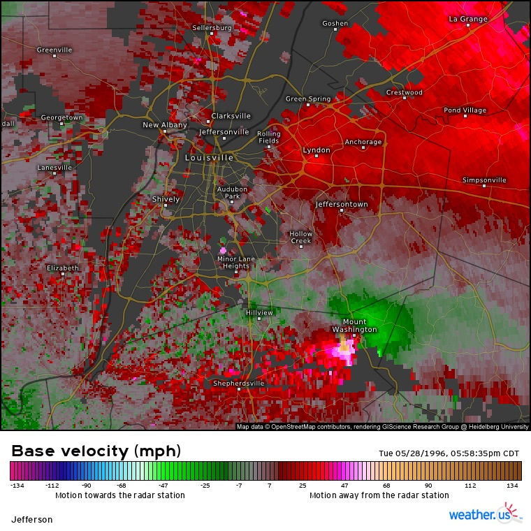
One of the most impressive radar presentations was this to ask. The Mesocyclone (rotating thunderstorm) had a hook echo and V-Shape appearance. That’s indicative of intense and large hail; where Southern Jefferson County was.


A multiple vortex Tornado began to take shape where severe damage took place over Pioneer Village/Hillview and Zoneton movng over Preston HWY and Bells Mill Rd to the ESE toward Mt Washington. A house suffered EF-4 damage in Pioneer Village where the tornado now changed shaped into a Wedge at times.
Thr tornado in Mt. Washington went through Old Mill Manor, Northfield subdivision causing extensive damage. It just grazed the heart of the central business district and travelled along KY-44 into wooded Spencer Co. Taylorsville took a glancing bow but trees looked like toothpicks toward Taylorsville Lake. Heavy tree damage occurred at the Marina and elsewhere. The supercell began to lose a little steam as a QLCS (Damaging Line of Wind) was catching up to it. The intense tornado continued along KY-44 and KY-248 into Anderson and soon Woodford Co where it died and wrapped up in the Line of storms.

IN ALL, the Supercell stayed either on the ground, cycled or produced damage ~ 90miles long! This was what I mentioned about a “steady state environment”. Nothing was in its way until the Line caught up with the Tornado.
What was amazing was that the storm produced no fatalities but there injuries. The storm was a generational event for some, myself included. Note on the bottom of a very strong couplet shown on Velocity. Strong winds blowing toward and away the radar were maxing out where they met over Mt Washington.
Let’s hope we don’t have another event like this again but we have seen setups like this one in May where a “northwest flow” event can occur and surprise.


Comments