


5/18 Monday: Wet & Unsettled
- silsmichael
- May 18
- 2 min read
Good Monday Evening, Chief Meteorologist Mike Sils with you here as we dive into data about Tonight, Tuesday, Wednesday and continuing Rain chances.
An old Outflow Boundary from Sunday Night in the Midwest has progressed Eastward over the Ohio Valley; where Heavy rainfall in Southern IN has prompted some flood warnings and localized and Isol’d wind damage reports. A new boundary is trying to drop South in KY where new rounds of showers can expand for parts of Central KY through the Overnight. Any rain will help; we ALL NEED IT.

TUESDAY:
The SPC (Storm Prediction Center) has placed a Level 2/5 for a line of strong to severe storms mainly along the River and points West. Main hazards at the Moment look to be Gusty Winds and small hail.

Wind Energy looks to remain very limited for these storms to grow as the Low Pressure is placed well North into Canada as the energy gets suppressed and stretched out.
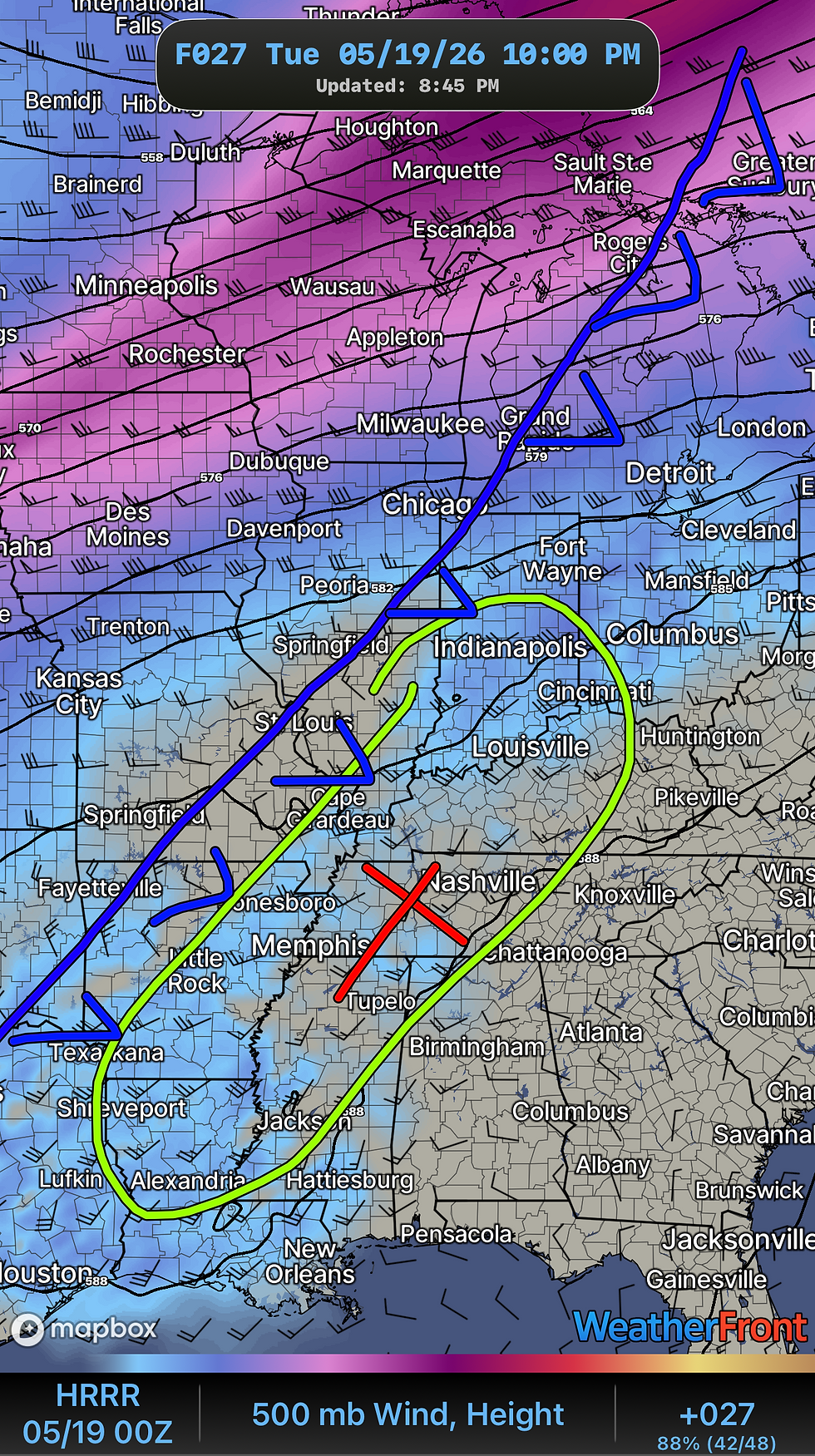

The Surface Map should look like this as Storms look to be scattered in nature. Best coverage of storms should stay to our Southwest along the Mississippi Delta.
BUT…. Rain chances look to stay with us as we roll into Wednesday and next Several days. The Cold Front will stall and leave the Boundary in placed over the TN/OH Valley, keeping Rain and Storm Chances through rest of the Week.
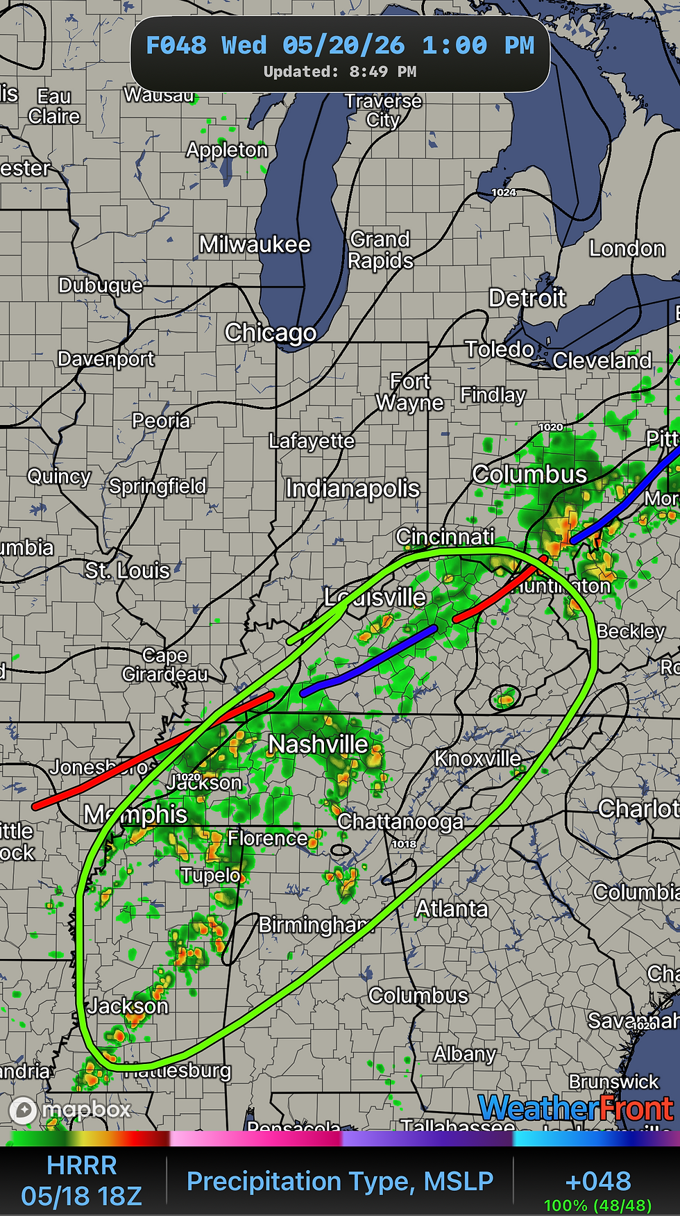
With that Boundary draped over us, some decent rain totals are possible! This could really help put a little dent on our rain deficit. Anywhere from 1”-2.5” is possible in some spots.

PERSONAL NOTE FROM US AT ZERO METER:
We hope to continue on these Blogs on a more consistent basis as all of us are working hard providing more content that is informative and personable.
Thank You for being a part of the ZMC community.


Comments